


Tropical Storm Arthur has formed as the first named storm of the Atlantic hurricane season
Baku, June 17, AZERTAC
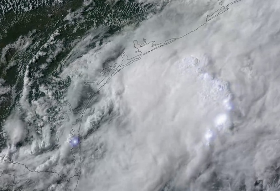
The first tropical storm of the Atlantic hurricane season formed Wednesday near the Gulf Coast, bringing intense rain and the threat of dangerous flash floods to states including Texas and Louisiana, meteorologists said, according to the Associated Press.
Tropical Storm Arthur was a disorganized cluster of storms that brought rain for days over parts of eastern Mexico and the Gulf. The National Hurricane Center in Miami said conditions were conducive for a short-lived tropical storm to form.
The center of Tropical Storm Arthur was located Wednesday morning about 40 miles (65 kilometers) east-northeast of Port O'Connor, Texas, according to an advisory. The storm was moving northeast near 9 mph (15 kph), and an increase in forward speed was expected.
Arthur had maximum sustained winds of 40 mph. Little change in strength is expected before the center moves over land, forecasters said. Weakening is anticipated once it moves inland, and it could dissipate by Wednesday night or early Thursday.
Arthur was not expected to gain much wind strength as the center of the storm moved over land. But forecasters said that doesn’t mean the system will be weak. Life-threatening flash flooding and urban flooding were the main threats as Arthur skirted the Gulf Coast. The hurricane center said in its key messages that flooding was likely through Friday over parts of Louisiana, Mississippi, Alabama, Georgia and the Florida Panhandle.
“Prolonged rainfall may extend the flood threat into the weekend,” National Hurricane Center director Michael Brennan said Tuesday.
Tropical Storm Arthur is expected to produce rainfall totals of 5-10 inches, with isolated higher totals near 20 inches. This could generate dangerous flash flooding. The combination of storm surge and the tide will cause normally dry areas near the coast to be flooded by rising waters moving inland from the shoreline.
Swells generated by Arthur are likely to cause life-threatening surf and rip current conditions along the northwestern Gulf Coast for the next couple of days. Tornadoes are possible through Thursday.
While San Antonio is expected to avoid the worst impacts, communities along the Texas Gulf Coast are already experiencing heavy rain and increasing flood concerns as bands of tropical moisture continue moving inland.
A Tropical Storm Watch remains in effect for the Texas Gulf Coast from Sargent to Sabine Pass, while portions of coastal Louisiana are under a Tropical Storm Warning. Tropical storm conditions are expected to develop across portions of the warning area within the next 24 hours.
The National Weather Service has issued a Flood Watch covering the entire Texas Gulf Coast, from Brownsville to Beaumont, including the Houston metropolitan area. Houston has already been under flood warnings as rounds of heavy rain continue to move through the region.
The Weather Prediction Center has placed much of the Texas coast, including Houston, Galveston, Corpus Christi, Victoria and Beaumont, under a Level 3 out of 4 risk for excessive rainfall and flash flooding.
Forecasters warn the storm could produce widespread rainfall totals of 5 to 10 inches through Thursday, with isolated amounts approaching 20 inches from the Texas coast eastward through Louisiana, Mississippi, Alabama, western Georgia and the Florida Panhandle.
China’s FM Wang Yi urges concrete implementation of Iran-US memorandum
Tropical Storm Arthur has formed as the first named storm of the Atlantic hurricane season
Norway's crown princess undergoes successful lung transplant, palace says
New rules for biotech crops clear final hurdle in European Parliament